
The Emerald Coast’s parks protect the wildest parts of the Florida Panhandle, from the brick walls of Fort Pickens near Pensacola to the jetties of St. Andrews State Park in Panama City Beach. In between are rare coastal dune lakes, 30-foot dunes, longleaf pine forests and, an hour inland, clear springs, tea-colored rivers and the highest point in Florida. This guide covers the best of them, west to east, with fees, what each park does best and how to plan a visit.
Quick answer
- Best wild beach: Topsail Hill Preserve State Park on 30A, with 3.2 miles of undeveloped sand.
- Best dune lake: Western Lake at Grayton Beach State Park.
- Best history: Fort Pickens in Gulf Islands National Seashore.
- Best snorkeling: the jetties at St. Andrews State Park in Panama City Beach.
- Easiest from Destin: Henderson Beach State Park, right in town. Reserve day use first.
- Best inland day trip: a spring swim at Ponce de Leon Springs or a paddle on the Blackwater River.
- Best fishing: Bear, Hurricane and Karick lakes in Blackwater River State Forest.
Emerald Coast parks at a glance
| Park | Where | Known for | Entry |
|---|---|---|---|
| Fort Pickens, Gulf Islands National Seashore | Pensacola Beach | 1830s fort, wild beach, camping | $25 per vehicle (7 days) |
| Big Lagoon State Park | Near Perdido Key | Salt marsh, birding, observation tower | Per vehicle |
| Fred Gannon Rocky Bayou State Park | Niceville | Bayou trails, boat ramp | Per vehicle |
| Henderson Beach State Park | Destin | 30-foot dunes, beach camping | $6 per vehicle, reservation required |
| Topsail Hill Preserve State Park | Santa Rosa Beach | 3.2 miles of wild beach, dune lakes | $6 per vehicle |
| Grayton Beach State Park | Grayton Beach | Western Lake, top-ranked beach, cabins | $5 per vehicle |
| Deer Lake State Park | Near Seagrove Beach | Quiet boardwalk and dune lake | $3 per vehicle |
| Point Washington State Forest | Behind 30A | Longleaf pine hiking and biking | Small day-use fee |
| St. Andrews State Park | Panama City Beach | Jetties, Shell Island shuttle | $8 per vehicle |
| Blackwater River State Park | Near Milton | Sandbars, canoeing, camping | $4 per vehicle |
| Blackwater River State Forest | North of Milton and Baker | Fishing lakes, paddling trails | Small day-use fees |
| Ponce de Leon Springs State Park | Ponce de Leon | 68-degree spring swimming | $4 per vehicle |
| Morrison Springs | Near Ponce de Leon | Spring diving and paddling | $4 per car |
| Britton Hill | North of DeFuniak Springs | Florida’s highest point | Free |
Fees change, so check each park’s listing or website before you go.
Gulf Islands National Seashore: the western anchor
Gulf Islands is federal land run by the National Park Service rather than a state park, but most visitors start here. On the Florida side it has six areas, including long, undeveloped stretches of Santa Rosa Island and Perdido Key, where the coast still looks the way it did before the condos arrived.
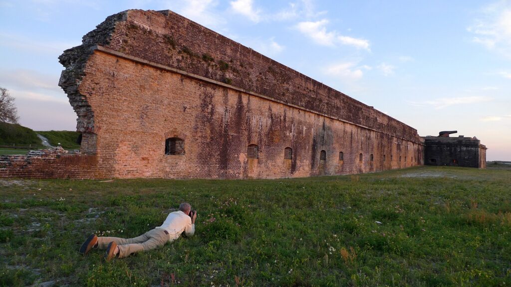

The Fort Pickens Area sits at the western tip of the island past Pensacola Beach. The brick fort was finished in 1834, stayed in Union hands through the Civil War and held the Apache leader Geronimo from 1886 to 1888. Langdon Beach has lifeguards in summer, the campground has 177 sites, and no fishing license is needed on the Fort Pickens pier. Entry is $25 per vehicle, good for seven days at all of the seashore’s Florida fee areas.
Two more seashore stops are worth a detour. The Naval Live Oaks Area in Gulf Breeze began in 1828 as the country’s first federal tree farm, growing live oaks for warship hulls. At the other end, Johnson Beach on Perdido Key has a road that ends after about a mile and a half, and past it the island is reachable only on foot.
Big Lagoon and the Perdido Key side
Big Lagoon State Park sits on the mainland facing Perdido Key, with salt marsh, tidal flats and boardwalk trails that birders love. Its observation tower looks out over the lagoon to the national seashore. It’s a good reminder that the Emerald Coast isn’t only Gulf front: the quiet bays behind the barrier islands hold much of the region’s wildlife. See our guide to Pensacola, Perdido Key and Navarre beaches for the rest of this end of the coast.
Bays and bayous between Navarre and Niceville
Between Navarre and Niceville, the water bends inland into bays and bayous. Fred Gannon Rocky Bayou State Park sits on a bluff above Rocky Bayou, off Choctawhatchee Bay, with sand pine trails and a boat ramp, and it stays quiet even in July. Nearby, the Turkey Creek Nature Trail follows a clear, spring-fed creek on a boardwalk, a shady alternative to a beach day.
Henderson Beach State Park: nature inside Destin
Henderson Beach State Park preserves about 1.25 miles of Gulf shoreline and 30-foot dunes in the middle of Destin, one of the busiest resort towns on the Gulf. A three-quarter-mile nature trail loops through the dunes, and 60 campsites connect to the beach by boardwalk. Since May 15, 2026, every car needs a day-use reservation, and entry is $6 per vehicle. See our Destin beaches guide for parking and access nearby.
The coastal dune lakes of South Walton
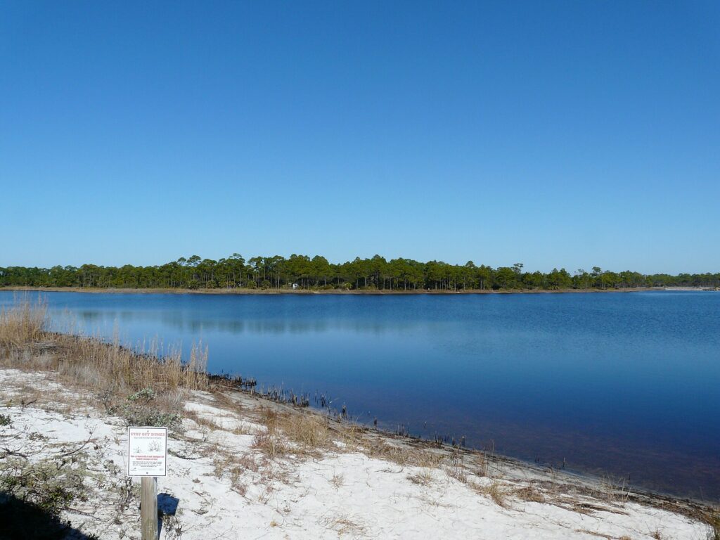
This is the region’s most remarkable natural feature. Walton County has 15 named coastal dune lakes along 26 miles of coastline. Similar lakes exist in only a few other places on Earth: Madagascar, Australia, New Zealand and Oregon. The lakes sit just behind the beach dunes and now and then break through the sand to flow into the Gulf, so fresh and salt water mix in a constantly shifting exchange. Three state parks protect them.

Grayton Beach State Park
Grayton Beach State Park is the classic way to see a dune lake. Western Lake, about 100 acres, sits framed by dunes a few steps from a beach that regularly lands on national best-beach lists. Paddle the lake in a rented canoe or kayak, walk the 1-mile nature trail, or book one of the park’s 30 cabins. Pair it with a walk through the old beach town of Grayton Beach.
Topsail Hill Preserve State Park
Topsail Hill Preserve State Park is bigger and wilder, with about 1,600 acres, three dune lakes including Campbell Lake, 3.2 miles of undeveloped beach and more than 10 miles of trails. A tram runs from the parking area to the beach. Personal kayaks aren’t allowed on the lakes, so rent from the park’s outfitter. The main beach boardwalk has been closed for construction since Sept. 16, 2026, with an alternate path near the tram station.
Deer Lake State Park
Deer Lake State Park is quieter and smaller, a short drive east of Seagrove Beach. An accessible boardwalk crosses the dunes to about half a mile of beach, and a 1.5-mile nature trail starts across 30A. Entry is $3 at an honor box.
Point Washington State Forest and the longleaf backcountry
Behind 30A stretches Point Washington State Forest, more than 15,000 acres of longleaf pine, wet prairie and cypress swamp. The Eastern Lake Trail has stacked loops of roughly 3.5, 6 and 11 miles for hiking and biking, and the Longleaf Greenway runs about 8 miles past old-growth pines. The forest connects to the paved Timpoochee Trail, which runs about 19 miles along 30A. See things to do on 30A for more.
St. Andrews State Park: the eastern anchor
St. Andrews State Park covers about 1,200 acres on a peninsula between the Gulf and the pass into St. Andrews Bay in Panama City Beach. Its rock jetties shelter a calm, clear pool that makes for the best casual shore snorkeling on the Panhandle. A shuttle runs to undeveloped Shell Island from March through Labor Day weekend. Bring everything you need, because the island has no services. Entry is $8 per vehicle.
Inland Wonders North of the Beaches
An hour or so inland, the coast’s white sand gives way to spring-fed rivers, clear springs and some of the last great longleaf pine forest in the Southeast. It’s a different Florida, and a good plan for a cloudy day or a break from the beach crowds.

Blackwater River State Forest and State Park
Blackwater River State Forest covers roughly 200,000 acres north of Milton and Baker. It’s the fishing treasure trove of the inland Panhandle: Bear Lake, Hurricane Lake and Karick Lake hold largemouth bass, bluegill, redear and catfish, with campgrounds, ramps and electric motors only. Juniper Creek is a scenic 6-mile paddling trail for beginners.
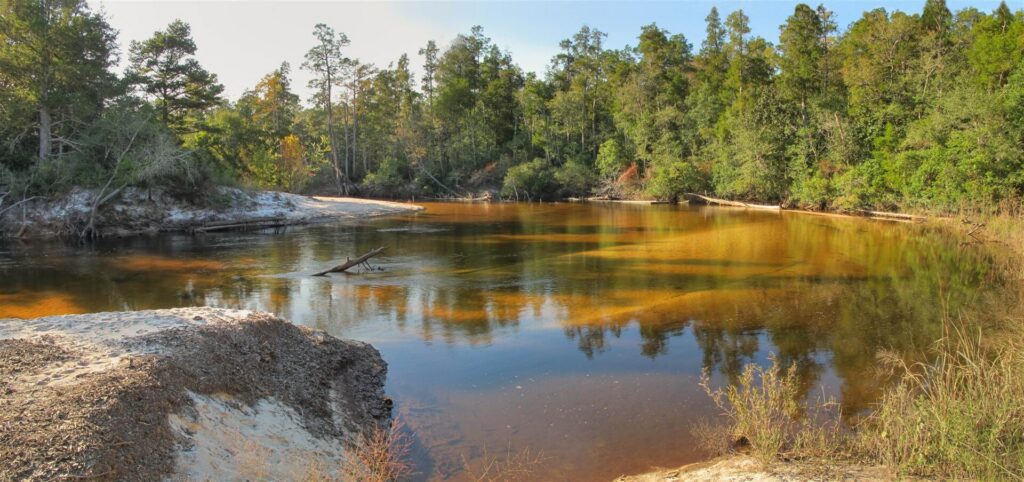
Downstream, Blackwater River State Park sits on the sand-bottom Blackwater River, where golden-brown water runs past wide white sandbars. Deaton Bridge is the take-out for canoe trips from Blackwater Canoe Rental and Adventures Unlimited. Entry is $4 per vehicle.
Shoal River
The Shoal River winds past Crestview as a 9.5-mile state paddling trail, shallow and gold-tinted, with plenty of sandbars for rest stops. Put in at the Ray Lynn Barnes Boat Ramp on U.S. 90 east of Crestview and take out at Shoal River Wayside Park on State Road 85. Anglers fish it for bass, bream and catfish. Avoid it at high water, when the current turns swift.
Britton Hill
Britton Hill in Lakewood Park is the highest natural point in Florida at 345 feet, and the lowest state high point in the country. A granite monument marks the top, short nature trails loop through the woods, and it’s free. It’s a fun stop for kids and anyone collecting state high points.
Ponce de Leon Springs and Morrison Springs
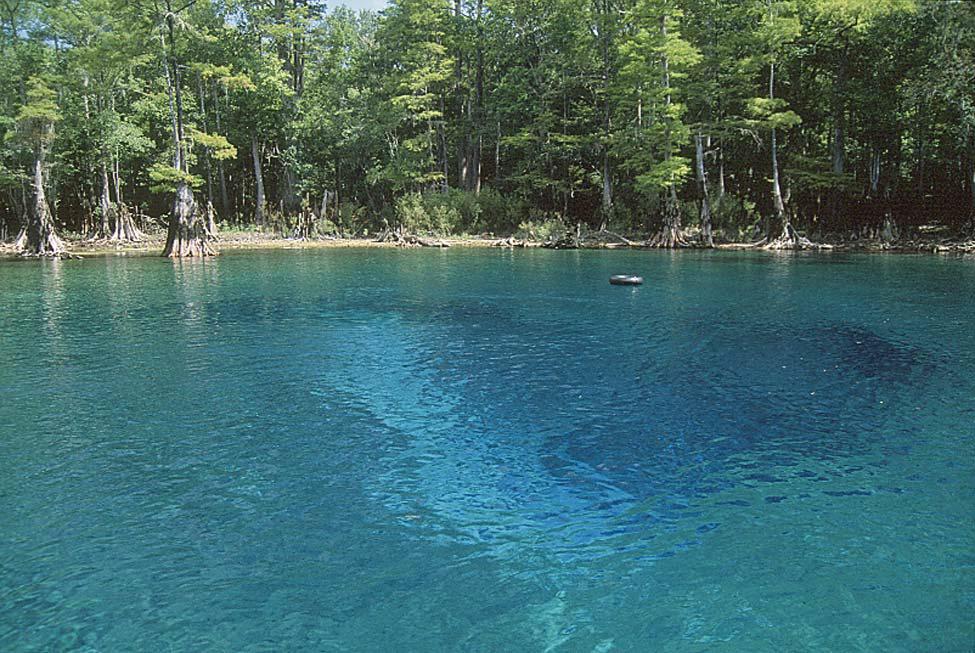
Ponce de Leon Springs State Park, just off I-10, is a spring-fed swimming hole that stays 68 degrees all year. About 15 minutes south, Morrison Springs is a 250-foot spring pool ringed by cypress, known for diving, snorkeling and paddling. From 30A, they’re closer, about an hour or less.

Timber Creek Distillery
Timber Creek Distillery makes an easy stop on an inland day. It’s a grain-to-glass distillery on a 240-acre family farm north of Crestview, about half an hour from the Shoal River and 40 minutes from Britton Hill. Tours and tastings run $20 to $30 per person, and dogs are welcome. Book a tour and tasting ahead, and read our Timber Creek story.
Planning your visit
- Go early. Parking at the most popular beach parks can fill by mid-morning in summer, and Grayton, Deer Lake and Ponce de Leon Springs close to new cars when they reach capacity.
- Book ahead. Henderson Beach requires a day-use reservation for cars. Campsites and cabins at Grayton, Topsail, Henderson and St. Andrews book up months ahead for spring and summer.
- Bring cash or a card. Some state parks use honor boxes with exact change, while the national seashore and Morrison Springs take cards only.
- Leave the dog at home for the beach. Dogs aren’t allowed on the beaches in these parks, though many allow leashed dogs on trails. See our dog-friendly guide.
- Stay off the dunes. Use the boardwalks. The sea oats holding the dunes together are the coast’s first defense against storms.
- Watch the weather. State forests close their recreation areas during tropical storm and hurricane warnings, and summer thunderstorms build fast in the afternoon.
Emerald Coast state parks FAQ
What is the best state park on the Emerald Coast? For a wild beach, Topsail Hill Preserve. For a coastal dune lake, Grayton Beach. For snorkeling, St. Andrews. For history, Fort Pickens in Gulf Islands National Seashore.
What are coastal dune lakes? Rare lakes that sit just behind the beach dunes and sometimes flow into the Gulf. Walton County has 15 named dune lakes along 26 miles of coastline, and similar lakes exist only in Madagascar, Australia, New Zealand and Oregon.
Where can you camp near the beach on the Emerald Coast? Grayton Beach, Topsail Hill Preserve, Henderson Beach and St. Andrews state parks, plus the Fort Pickens campground in Gulf Islands National Seashore.
Do you need a reservation for Henderson Beach State Park? Yes, if you’re driving. Since May 15, 2026, every car needs a day-use reservation.
Where can you swim in a spring near Destin? Ponce de Leon Springs State Park and Morrison Springs, about an hour and a half from Destin and about an hour from 30A. Closer in, the Turkey Creek Nature Trail in Niceville follows a clear, spring-fed creek.
What is the highest point in Florida? Britton Hill, at 345 feet, in Lakewood Park north of DeFuniak Springs.
Where is the best freshwater fishing near the Emerald Coast? The lakes of Blackwater River State Forest: Bear, Hurricane and Karick, for bass, bream and catfish.
More outdoors: the best beaches on the Emerald Coast, 30A beaches and Panama City Beach beaches.